Traditionally, LiDAR laser scanning has mostly been used for geospatial mapping, but this is slowly starting to change, with the technology making its way onto everyday iPhones.
Once the preserve of architecture firms with thousands of dollars to spend on dedicated hardware, LiDAR has now entered the mainstream. No longer just for long-distance capture, it’s increasingly being utilized for AR measuring, avatar modeling, and more.
But what exactly is LiDAR? With many smartphone owners still oblivious to how it works, there’s a risk that they’re missing out on an opportunity to take advantage of this emerging trend.
Given how cheap smartphones are compared to tripod 3D scanners, traditional LiDAR users may also be wondering how their device stacks up. If you lie in either one of these camps (or you just want to find out more about LiDAR in general) you’re in the right place.
For the newcomers, let’s start by breaking down how the technology works, then move on to the latest applications, before asking the big question: Where is LiDAR headed next?
How does LiDAR work?
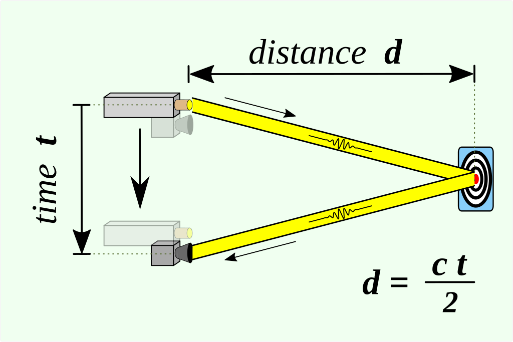
LiDAR or ‘light detection and ranging’ is fundamentally a time-of-flight technology. This means it captures a digital picture of its surroundings by emitting a laser pulse, measuring how long it takes for this to bounce back, and calculating the distance to a target object.
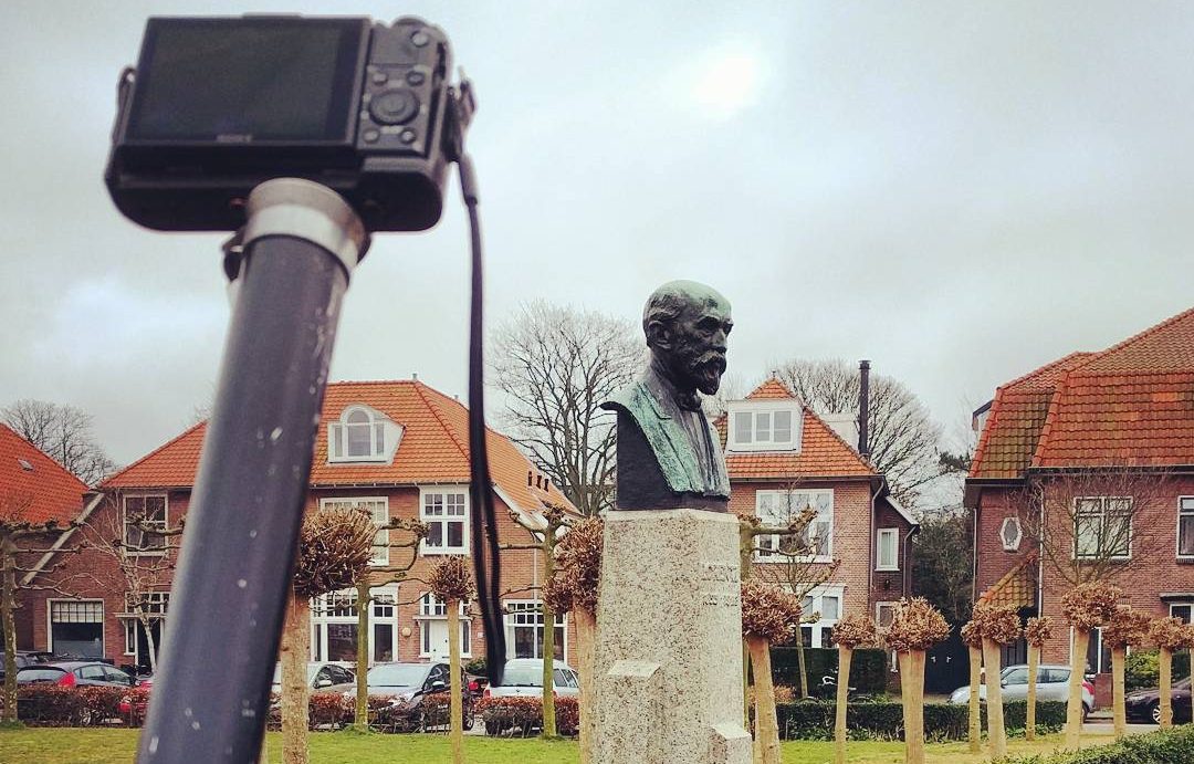
Typically, this calculation is carried out using an Inertial Measurement Unit (IMU) and built-in GPS, which help such devices work out plane orientation and light energy location. Capable of capturing huge objects from over a hundred meters away, most industrial LiDAR 3D scanners also come with a tripod, so users can complete other tasks while their scan takes place.
Of course, there are many other laser scanning technologies out there. Structured light capture, for instance, is widely used to power professional handheld 3D scanners. Though generally more agile and accurate than LiDAR devices, they tend to be shorter range – making them better suited to digitizing intricate items up close than scanning at scale.
Smartphone LiDAR is slightly changing this equation – bringing handheld scanning portability to the technology – though it doesn’t capture geometry data, limiting its potential use cases.
Then you have technologies like photogrammetry. This involves taking overlapping pictures from all around a target object and digitally merging them together. If carried out flawlessly, it can yield 3D models with a photorealistic appearance – hence its popularity in CGI. But this can be tricky, and it too yields less accurate digitizations than professional 3D scanning.
Then again, you don’t necessarily have to choose one technology over another.
For models that are both geometrically accurate and stunningly lifelike, you can combine 3D scanning with photo capture on Artec Studio. In the software, you can even merge multiple scans (LiDAR or not) for incredible resolution, though this does yield huge meshes.
So, to summarize: LiDAR is still king when it comes to accurate capture at scale. It’s not a jack of all trades, but it can be combined with other technologies to address its shortcomings.
How to use LiDAR on your iPhone
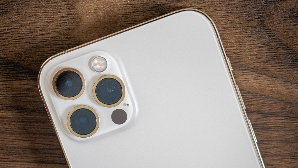
Good news! If you have an iPhone Pro 12 to15, a third-gen 11-inch iPad Pro, or a fifth-gen 12.9-inch iPad Pro, you already have LiDAR. There used to be options like the Galaxy S20 for Android users, but most manufacturers have since done away with the technology. As such, non-Apple users have now been left a little out in the cold when it comes to LiDAR.
For those lucky enough to have the functionality, it’s actually very easy to use. iPhone LiDAR may only have a range of five meters, but in practice, it’s very intuitive – point, shoot light pulses at an object or area, and watch your device use gathered data to build a model on-screen.
With apps like Polycam and 3D Scanner App, it’s also possible to access smartphone tools that make it easier to capture, edit, measure, and share scans of the world around you. Users can even toy with AR to enter the virtual realm with fun, immersive visual effects.
But you don’t necessarily need to download apps to see meaningful benefits. Taking photos with LiDAR boosts the focus accuracy and speed of smartphone cameras, resulting in visibly sharper images – especially in low-light conditions.
Top LiDAR applications
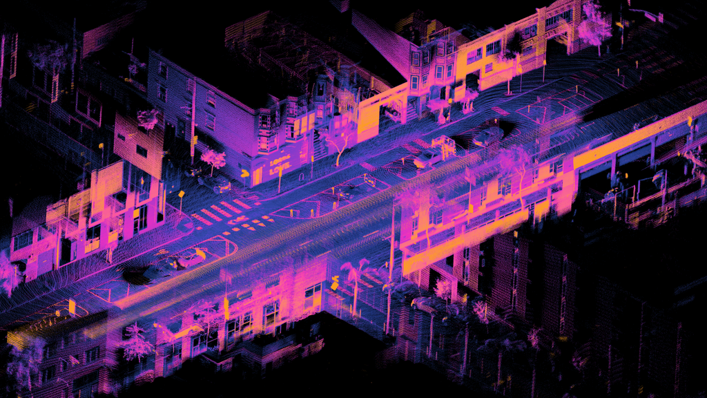
Let’s move onto use cases, starting with professional LiDAR 3D scanning. LiDAR continues to be essential for gathering the accurate mapping data needed for construction site planning. In the field of heritage preservation, it’s also used to digitally ‘back up’ historic sites.
Take JIE Technology’s project in Shenzhen, China. With an Artec Ray LiDAR scanner, its team managed to digitize a 15-meter-tall Buddhist statue, preserving it for future generations. In other cases, LiDAR scanners have been mounted to drones for reconnaissance. Earlier this year, it was even reported that aerial LiDAR had helped uncover a lost city in the Amazon.
As well as construction planning and heritage preservation, LiDAR has found all sorts of other mapping applications, from hazard assessment to agricultural analysis.
By contrast, smartphone LiDAR scanning is all about close-up, high-resolution results. This could be in the taking of better photos, measuring rooms to ensure furniture fits, or advanced AR applications. For instance, some opticians now allow users to ‘try-on’ glasses virtually.
A handful of games on Apple’s App Store also feature AR functionality, so players can take on virtual challenges set in real-world environments. The technology’s potential to bring the virtual and real worlds crashing together is arguably one of its more exciting applications.
On the flipside, iPhone LiDAR’s much-touted 3D modeling capabilities come with a ton of caveats that limit its potential. If you want to create digital replicas of people or objects for your own amusement, it’s a fun way of doing so. But, look beyond the realistic outer shell of resulting models, and you’ll see there’s little-to-no geometry. Not ideal for practical use cases!
What next for LiDAR 3D scanning?

There’s no doubt LiDAR’s most lucrative application remains geospatial mapping. But recent innovation both in-and-outside traditional 3D scanning is also broadening its horizons. It’s now possible to combine LiDAR scans with data captured by more accurate handheld 3D scanners to create large-scale 3D models that feature an incredible level of detail.
LiDAR is also taking off in the guidance of autonomous vehicles. From the SpaceX Dragon spacecraft to early versions of Google self-driving cars, it has shown huge potential in this area.
Then there’s Apple’s commitment to the technology. Yes, the company has a habit of rubbing some customers the wrong way (we’re looking at you Android fans). But it has absolutely mastered the art of bringing existing technologies to new audiences.
By integrating LiDAR into its last four iPhones, Apple has done just that: brought 3D scanning to a different user base altogether. Whether it be related to modeling, mapping, AR, or something else entirely, it’s exciting to imagine what they’ll do with this fresh power at their fingertips!
If you’re looking for a professional LiDAR device, be prepared to do a lot of research. There are plenty of options, many of which aren’t cheap. But if you work in construction or heavy industry, these far outstrip iPhones. So it may still be worth investing your time (and money) here.