Imagine turning a bunch of high-res photographs into an ultra-realistic 3D model. In a nutshell, that is the power of photogrammetry – the process of capturing images and stitching them together to create a digital twin of the real-world object. From mapping Mars to reconstructing ancient ruins, photogrammetry is the art, science, and technique behind some of the most fascinating digital reconstructions.
Photogrammetry plays a vital role across industries, from archaeology and heritage conservation, where it helps digitally preserve ancient relics, to construction and surveying, where it enables the precise 3D modeling of buildings and infrastructure. In film, TV, and gaming, it creates environments and characters with stunning fidelity, as seen in blockbuster productions. Forensics relies on photogrammetry for accurate crime scene reconstruction, while terrain mapping uses it to analyze geographical features. Even sectors like healthcare benefit from photogrammetry, with 3D imaging crucial in surgical planning and prosthetic design.
What is photogrammetry and how does it work?
The classic definition of photogrammetry is the process of extracting accurate models and 3D measurements from overlapping images using computational algorithms. This means capturing images and stitching them together to create precise topographical maps, meshes, and lifelike 2D and 3D digital models. Think of it as a digital puzzle coming together from different pictures and perspectives, or a virtual sculptor, chiselling away at a collection of photographs, gradually revealing a lifelike 3D model from the raw set of pixels.
The basic principle behind the technology is that good photogrammetry needs the right dataset, so it involves capturing overlapping visuals from various angles, detecting common reference points, and using cutting-edge algorithms to get accurate 3D coordinates, measurements, and models. The more images are captured, the more true-to-life and detailed the 3D model is.
Photogrammetry: A brief history
With the amazing technological advancements of today, photogrammetry may seem a new concept, but in fact, it’s been around for quite a while. Reconstructing measurements based on principles of perspective and projective geometry dates back to the Renaissance and Leonardo da Vinci. Much later, in 1851, French inventor Aimé Laussedat, also known as the “father of photogrammetry,” pioneered the use of terrestrial photographs for mapping. Finally, it was German mathematicians, including Carl Pulfrich and Otto von Gruber, who formalized photogrammetry as a scientific discipline in the late 19th century. They applied geometric principles to calculate accurate measurements from photographic images, an idea that would later become central to 3D mapping and surveying.
The early 20th century saw head-spinning development of aerial photogrammetry, streamlined by breakthroughs in aviation and its military uses during World War I and II. In the mid-to-late 20th century, computers completely transformed the field, making automated image processing and 3D reconstruction possible. Today, photogrammetry keeps evolving with next-gen AI-based software, drone technology, and satellite imaging.
Users can now achieve unprecedented levels of immersion in 3D visualizations. The technique has paved the way for an entire range of reality capture technologies that collect data to provide reliable information about any physical object or environment.
Types of photogrammetry
With five centuries of development and mind-blowing technological innovation, photogrammetry has evolved into four main types:
- mobile,
- aerial,
- terrestrial,
- and satellite.
Each type is tailored to different applications, from mapping immense landscapes to capturing minute details on the ground to even observing the planet from space.
Mobile photogrammetry
Mobile photogrammetry has emerged as a robust tool for creating high-quality 3D models, offering a consumer-friendly, accessible alternative to traditional high-end digitization methods. This approach leverages everyday mobile devices such as smartphones, digital cameras, or portable scanners that can easily capture multiple high-resolution images.
Affordable, versatile, and easy to use, mobile photogrammetry can be performed by anyone with a smartphone or a consumer-grade camera. This democratizes 3D modeling, making it accessible to a diverse range of users, from hobbyists and artists to educators and small business owners. Modern mobile devices boast increasingly powerful cameras and built-in sensors, making them ideal for quick and flexible image capture in any environment.
Aerial photogrammetry
Aerial photogrammetry positions the camera in the air, attached to a drone or any other type of aircraft. While in flight, the camera “looks” toward the ground and captures overlapping images of the same area from as many angles as possible. This type of technology is commonly used on massive sites or in hard-to-reach areas.
During mapping a stereoplotter is utilized to calculate elevations by analyzing multiple photos of the same point, which is helpful in applications like natural resource management or disaster response.
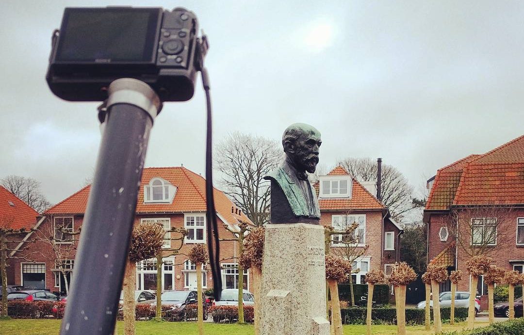
Terrestrial photogrammetry
Terrestrial (close-range) photogrammetry involves taking photographs with a ground-based camera, which can be handheld or attached to a tripod or any other support system. Professionals in surveying, for example, use a theodolite to capture high-resolution images on the ground, recording the coordinates of the camera to keep track of its positions.
These images are analyzed by algorithms to generate and process 3D data. Terrestrial photogrammetry is more object-focused and usually enables more detailed image capture.
Satellite photogrammetry
Satellite photogrammetry is a remote sensing technique that relies on satellite imagery to create 3D models, maps, and measurements of Earth’s surface. By capturing numerous images from different angles, satellites generate digital elevation models (DEMs) for environmental monitoring, agriculture, urban planning, and disaster management.
One example is NASA’s ICESat-2 satellite, which applies photogrammetric principles to detecting changes in polar ice sheets, contributing to climate change research. From large-scale crop health assessments to obtaining real-time data during earthquakes and floods, this type of photogrammetry offers increasingly precise global mapping.
How photogrammetry works
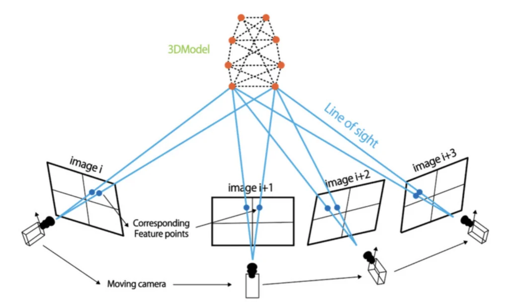
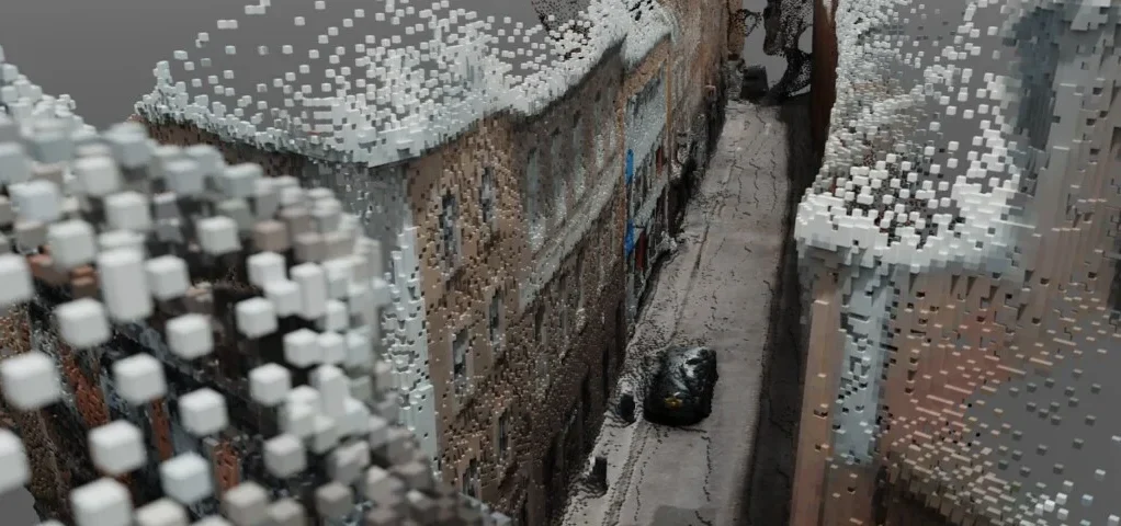
Essentially, photogrammetry works by analyzing perspective and reversing the conventional photography process. While a camera captures a 3D object or scene and turns it into a 2D image, photogrammetry does the opposite: it takes multiple 2D images and reconstructs a 3D model by extracting depth and spatial information. Photogrammetry software then identifies common points in overlapping images and applies geometric algorithms to calculate dimensions, distances, and surface details. Behind this process are the principles of optics and mathematics to infer an object’s physical properties, similar to the way human vision perceives depth. If we have a sufficient number of images taken from different angles, photogrammetry can recreate entire objects, landscapes, or architectural structures in glorious 3D.
Different photogrammetry programs offer varying levels of functionality, accuracy, and processing speed. With an entire line-up of options available, from free tools to high-end professional suites, understanding your budget, goals, and specific project needs is crucial.
Free photogrammetry software
Free photogrammetry software can be an accessible entry point for newbies, hobbyists, and researchers who like to experiment with 3D reconstruction with little to no financial investment. Programs like AliceVision Meshroom or VisualSFM use Structure-from-Motion (SfM) algorithms that process overlapping images and generate point clouds, making them great for basic modeling and educational purposes. 3DF Zephyr, in turn, offers a user-friendly interface with automated workflows, although the number of images that can be processed is limited. While it is entirely possible to achieve impressive results with these free tools, they may require additional plugins for advanced features. They also tend to be slower and less optimized for large datasets compared to professional-grade software. Despite these limitations, free solutions are excellent for learning the fundamentals of photogrammetry before investing in more advanced tools.
Professional photogrammetry software
For seasoned professionals and enterprises demanding high accuracy, speed, and advanced feature sets, high-end photogrammetry suites are more suitable. These robust solutions are usually tailored to specific industries. For example, Agisoft Metashape is known for its advanced depth map-based dense cloud generation and precise georeferencing, making it a popular choice in surveying, archaeology, and forensics. Pix4D specializes in drone-based photogrammetry, RealityCapture is favored in the entertainment and gaming industries, and Hexagon’s Aicon 3D Studio and Photomodeler cater to metrology and industrial applications. While all these tools are famous for superior performance and seamless integration with GIS, CAD, and 3D visualization platforms, they also come at a premium price, and have a steep learning curve.

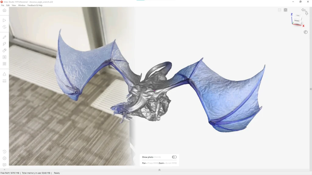
One solution that combines the pros of both categories is Artec Studio’s AI Photogrammetry, an all-in-one tool that transforms any photo or video data into watertight 3D models. Unlike most traditional photogrammetry software, which relies on image-based processing exclusively, Artec Studio integrates AI algorithms to enhance data alignment, reduce noise, and improve texture mapping for incredibly realistic digital twins. After capturing and uploading visuals from any device, whether it be a camera, smartphone, drone, or scanner, the advanced algorithms automatically align images and detect fine features. The software then reconstructs a detailed 3D model, ready for refinement or immediate use.
When choosing your ideal photogrammetry software, consider the amount of key steps photogrammetric analysis would involve. While it’s just three intuitive phases with AI Photogrammetry, most high-end suites require additional steps. Generally, the process begins with image import and preprocessing, where overlapping images are loaded, and quality checks are performed to remove blurry or poorly exposed shots. This is followed by image alignment, feature detection, and the identifying of common points across images. Next up, is the creation of a sparse point cloud and the forming of an initial 3D structure, which can then be refined into a dense point cloud for enhanced detail. High-resolution textures from the original images are often applied to the 3D mesh, helping to create a realistic representation. Finally, the processed results, whether 3D models, point clouds, or DEMs, can be exported and integrated into GIS, CAD, or 3D visualization platforms for further analysis and application.
Applications of photogrammetry


Entertainment and media
In the entertainment industry, media, and CGI, photogrammetry creates ultra-realistic 3D environments and assets for video games, films, TV, and VR. By capturing real-world textures and details, photogrammetry brings visual authenticity to any digital content.
Avatars
Realistic digital avatars are created with the help of photogrammetry to enable a more immersive experience in various virtual environments and applications.
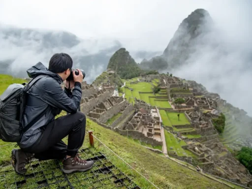
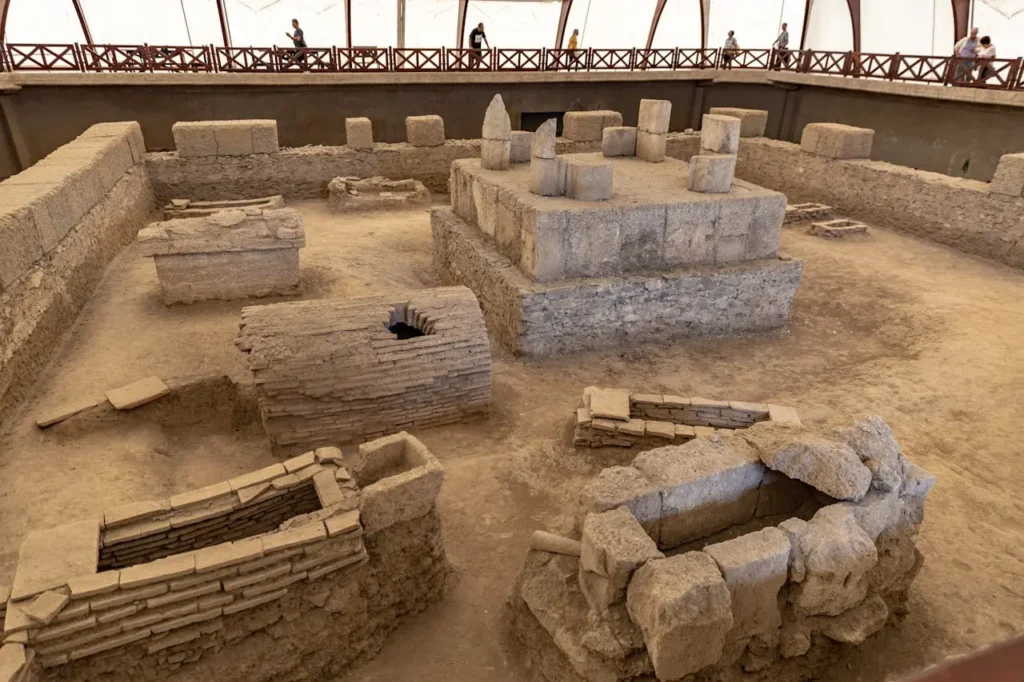
Heritage preservation and archaeology
Invaluable in digitally preserving and documenting fragile archaeological artifacts and iconic cultural sights, photogrammetry is instrumental in safely creating accurate 3D models for research, restoration, and future restoration.
Surveying and mapping
Photogrammetry is widely used to generate accurate topographic maps and 3D terrain models by analyzing aerial or drone-captured images. These maps are essential for land development, urban planning, and environmental studies.
Architecture and construction
The technology helps to document existing structures and create detailed 3D models for restoration, preservation, and renovation projects. It allows architects and engineers to assess buildings without needing to adopt invasive methods.
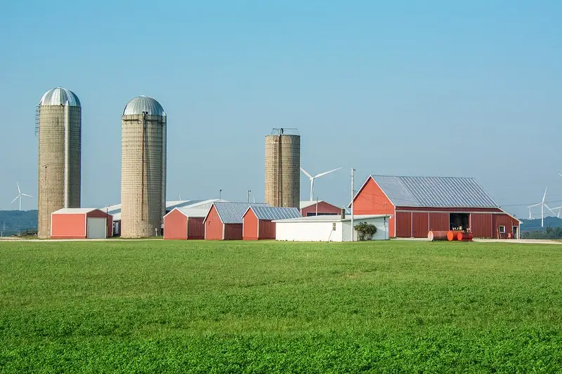
Agriculture
Farmers and agronomists use photogrammetry to monitor crop health, detect pests, and optimize their resources using aerial imaging and analysis. The technology provides actionable insights that improve efficiency in precision farming.
Underwater exploration
The technique helps create 3D models of submerged landscapes, shipwrecks, and marine life. These digital replicas aid in scientific research, conservation efforts, and virtual tours, making underwater sites accessible to a wider audience with no risk of disturbing the environment.
Forensics
Forensic investigators can create accurate 3D models to reconstruct crime scenes, preserving evidence digitally for analysis and court presentations.
Advantages of Photogrammetry

- Exceptional detail capture
Photogrammetry captures a level of detail that’s difficult, if not impossible, to match with alternative digitization solutions, making it a valuable tool across multiple applications, be it 3D modeling or topographic mapping. We’d be hard pressed to name an application where texture doesn’t matter, and photogrammetry’s eye for detail continues to make it attractive across industries.
- More cost-effective than alternative methods
The technique is also a cost-effective alternative to the likes of LiDAR, as it requires only a camera and processing software rather than expensive hardware. This makes it ideal for industries such as agriculture, where drones equipped with cameras can help farmers at a fraction of the cost of conventional surveying methods.
- Quick coverage of large areas
Another major advantage is photogrammetry’s ability to cover large areas rapidly, especially when used in aerial surveys. For example, in disaster response, the technology is instrumental in creating 3D maps of earthquake or flood-affected regions, aiding in rescue and reconstruction.
Challenges and limitations
- Dependent on weather and lighting conditions
Dependence on cloud cover, shadows, and lighting conditions is one of the main challenges photogrammetry faces. Inconsistent brightness will greatly affect image quality, meaning it is difficult to generate accurate 3D models in outdoor environments with uncontrolled lighting.
- Complex processing and analysis
The processing and analysis of photogrammetric data is not exactly a breeze: computationally intensive, this may well require powerful hardware, especially if high-end software like Agisoft Metashape or Pix4D is used.
- Prone to errors from image quality
Errors can arise from poor image quality, such as blurriness, distortion, or insufficient overlap between hundreds of images. In archaeological documentation, for instance, low-res images often fail to capture fine surface details, resulting in incomplete reconstruction.
Future trends in photogrammetry
Photogrammetry has made exciting and significant strides with the integration of AI, which has taken the accuracy, efficiency, and automation of the process to a completely new level. AI algorithms, like those in Artec Studio, can now automatically detect fine features, align images, and even identify subtle details to achieve results that would have been unattainable for traditional solutions. Machine learning models keep improving over time, being fed more and more data, so photogrammetry systems are becoming smarter, faster, and more accurate. All this enables professionals across different sectors to generate ultra-detailed 3D models and minimize manual intervention, hence reducing both lead times and the potential for human error.
Drone technology has also been vital in advancing photogrammetry, offering the chance to capture high-res images from previously unreachable or dangerous locations. Drones provide incredibly precise aerial imaging in real-time, which is crucial for efficient large-scale mapping and the surveying of outdoor areas, buildings, and infrastructure. Combined with improvements in photogrammetry software, such as more powerful image processing or enhanced data integration, this has sped up photogrammetric analysis. Software updates now support increasingly complex tasks, with automated mesh creation, texture mapping, and GIS integration, just to name a few. Photogrammetry is versatile like never before, having become indispensable for a diverse range of industries.
From the Earth to the skies and even beyond, photogrammetry has revolutionized how we see and map the world. Whether it’s surveying vast landscapes, creating ultrarealistic video game worlds, or digitally preserving a cultural gem, photogrammetry is a game-changer. With AI integrated and the right software doing most of the heavy lifting, top-quality 3D models are now just a few clicks away. After centuries of development, photogrammetry has reached the crossroads of innovation, with the potential to transform global industries. As technology continues to evolve, photogrammetry is set to become even more accurate, accessible, and reliable.
Frequently Asked Questions
What is photogrammetry used for?
Photogrammetry is a technique that stitches numerous photos into 3D models, maps, and measurements, making it easy for anyone to create accurate digital representations of objects or spaces. With just a smartphone or digital camera, it is now entirely possible to use photogrammetry for various purposes, from capturing a fascinating object for 3D printing to documenting a home renovation project, or exploring a virtual museum. On a broader scale, it is also used across diverse industries, from creative sectors like CGI, architecture, and archaeology to more technical applications such as construction or forensics.
How accurate is photogrammetry?
The accuracy of photogrammetry depends on many factors, including camera quality, image resolution, and control points, but it can achieve sub-millimeter precision in close-range applications. For large-scale mapping, accuracy typically ranges from a few centimeters to meters.
What is the difference between photogrammetry and LiDAR?
Photogrammetry reconstructs 3D models from overlapping photographs using visual data, while LiDAR uses laser pulses to measure distances directly. LiDAR provides higher accuracy in dense vegetation and poor lighting conditions, whereas photogrammetry is more budget-friendly and detailed in texture capture. Additionally, handheld 3D scanners, which can use structured light or laser-based methods, offer another versatile option for capturing objects and environments with high accuracy.
Which software is best for photogrammetry?
The best choice depends on specific needs of a particular project, such as accuracy, processing speed, and budget. Among some of the best photogrammetry tools in different categories are Artec Studio’s AI Photogrammetry, Agisoft Metashape, Pix4D, and RealityCapture, each offering reliable 3D reconstruction tools.
Can photogrammetry be used underwater?
Yes, photogrammetry can be used underwater, but it requires specialized techniques to compensate for light refraction and distortion. High-quality cameras, calibrated setups, and proper lighting help improve accuracy in underwater environments.